
Avoiding Mistakes in Drone Usage in Participatory Mapping: Methodological Considerations during the Pandemic
DOI:
https://doi.org/10.24259/fs.v6i1.14117Keywords:
Participatory mapping, Drones, Pandemic, Orthomosaic, InterpretationAbstract
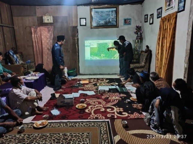
Participatory mapping has continued to evolve with the onset of new methodologies and technology. Conventional methods for sketching have now expanded to incorporate the use of drone imagery and other sophisticated mapping approaches as a base map. However, the use of ultra-high resolution drone imagery does not mean that it will facilitate more participatory processes nor improve the quality of data and uses of information. Indeed, it has long been known that ultra-high spatial resolution can cause misinterpretation. During COVID-19, innovations are emerging to apply more remote technologies in participatory mapping. Mobility concerns, requirements, and preferences for physical distancing discourages active participation of local communities and are especially complex in contexts involving Indigenous People. This paper specifically explores the mistakes that can arise from over-reliance on employing drones as a tool in participatory mapping methods. This paper is based on a case study of participatory mapping conducted at 43 villages (around forest area) of Central Sulawesi Province and West Sulawesi Province. The participatory mapping was carried out by the Sulawesi Community Foundation (SCF) from 2019-2021. The result of the study found at least six signs of potentially negative outcomes from the use of ultra-high resolution drone imagery, starting from disorientation, misperception over the periods of drone acquisition, homogeneous land cover conditions, similar types of plants, numerous signs of nature, and labeling affixed on map. We also encourage the development of ultra-high-resolution drone imagery to take place under certain conditions and see its role as an interpretation dictionary or as a targeted tool in local contexts. In addition, we found that the level of active participation in participatory mapping during the Pandemic was higher than before the pandemic but requires some improvisations in meeting design
References
Abdel-Basset, M., Chang, V., & Nabeeh, N. A. (2021). An intelligent framework using disruptive technologies for COVID-19 analysis. Technological Forecasting and Social Change, 163, 120431. https://doi.org/10.1016/J.TECHFORE.2020.120431
Álvarez Larrain, A., Greco, C., & Tarragó, M. (2021). Participatory mapping and UAV photogrammetry as complementary techniques for landscape archaeology studies: an example from north-western Argentina. Archaeological Prospection, 28(1), 47–61. https://doi.org/10.1002/arp.1794
Brambach, F., Leuschner, C., Tjoa, A., & Culmsee, H. (2017). Diversity, endemism, and composition of tropical mountain forest communities in Sulawesi, Indonesia, in relation to elevation and soil properties. Perspectives in Plant Ecology, Evolution and Systematics, 27, 68–79. https://doi.org/10.1016/J.PPEES.2017.06.003
Brem, A., Viardot, E., & Nylund, P. A. (2021). Implications of the coronavirus (COVID-19) outbreak for innovation: Which technologies will improve our lives? Technological Forecasting and Social Change, 163, 120451. https://doi.org/10.1016/J.TECHFORE.2020.120451
Chambers, R. (2006). Participatory Mapping and Geographic Information Systems: Whose Map? Who Is Empowered and Who Disempowered? Who Gains and Who Loses?. The Electronic Journal on Information Systems in Developing Countries, 25(1), 1-11. https://doi.org/10.1002/j.1681-4835.2006.tb00163.x
Churiyah, M., Sholikhan, S., Filianti, F., & Sakdiyyah, D. A. (2020). Indonesia Education Readiness Conducting Distance Learning in Covid-19 Pandemic Situation. International Journal of Multicultural and Multireligious Understanding, 7(6), 491. https://doi.org/10.18415/ijmmu.v7i6.1833
Citterio, A., & Piégay, H. (2009). Overbank sedimentation rates in former channel lakes: characterization and control factors. Sedimentology, Vol. 56(N 2 (February 2009)), 461–482. https://doi.org/10.1111/j.1365-3091.2008.00979.x
Colloredo-Mansfeld, M., Laso, F. J., & Arce-Nazario, J. (2020). Uav-based participatory mapping: Examining local agricultural knowledge in the Galapagos. In Drones (Vol. 4, Issue 4, pp. 1–13). MDPI AG. https://doi.org/10.3390/drones4040062
Dandois, J. P., Olano, M., Ellis, E. C., Baghdadi, N., Kerle, N., & Thenkabail, P. S. (2015). Optimal Altitude, Overlap, and Weather Conditions for Computer Vision UAV Estimates of Forest Structure. 7, 13895–13920. https://doi.org/10.3390/rs71013895
Franch-Pardo, I., Napoletano, B. M., Rosete-Verges, F., & Billa, L. (2020). Spatial analysis and GIS in the study of COVID-19. A review. Science of The Total Environment, 739, 140033. https://doi.org/10.1016/J.SCITOTENV.2020.140033
González-García, J., Swenson, R. L., & Gómez-Espinosa, A. (2020). Real-time kinematics applied at unmanned aerial vehicles positioning for orthophotography in precision agriculture. Computers and Electronics in Agriculture, 177, 105695. https://doi.org/10.1016/J.COMPAG.2020.105695
Goswami, R., Roy, K., Dutta, S., Ray, K., Sarkar, S., Brahmachari, K., Nanda, M. K., Mainuddin, M., Banerjee, H., Timsina, J., & Majumdar, K. (2021). Multi-faceted impact and outcome of COVID-19 on smallholder agricultural systems: Integrating qualitative research and fuzzy cognitive mapping to explore resilient strategies. Agricultural Systems, 189, 103051. https://doi.org/10.1016/J.AGSY.2021.103051
Haqiqi, I., & Horeh, M. B. (2021). Assessment of COVID-19 impacts on U.S. counties using the immediate impact model of local agricultural production (IMLAP). Agricultural Systems, 190, 103132. https://doi.org/10.1016/J.AGSY.2021.103132
Iese, V., Wairiu, M., Hickey, G. M., Ugalde, D., Salili, D. H., Walenenea Jr, J., ... & Ward, A. C. (2021). Impacts of COVID-19 on agriculture and food systems in Pacific Island countries (PICs): Evidence from communities in Fiji and Solomon Islands. Agricultural Systems, 190, 103099. https://doi.org/10.1016/J.AGSY.2021.103099
Kotivuori, E., Kukkonen, M., Mehtätalo, L., Maltamo, M., Korhonen, L., & Packalen, P. (2020). Forest inventories for small areas using drone imagery without in-situ field measurements. Remote Sensing of Environment, 237, 111404. https://doi.org/10.1016/J.RSE.2019.111404
Middendorf, B. J., Faye, A., Middendorf, G., Stewart, Z. P., Jha, P. K., & Prasad, P. V. V. (2021). Smallholder farmer perceptions about the impact of COVID-19 on agriculture and livelihoods in Senegal. Agricultural Systems, 190, 103108. https://doi.org/10.1016/J.AGSY.2021.103108
Orengo, H. A., & Garcia-Molsosa, A. (2019). A brave new world for archaeological survey: Automated machine learning-based potsherd detection using high-resolution drone imagery. Journal of Archaeological Science, 112, 105013. https://doi.org/10.1016/J.JAS.2019.105013
Paneque-Gálvez, J., Mccall, M. K., Napoletano, B. M., Wich, S. A., & Koh, L. P. (2014). Small Drones for Community-Based Forest Monitoring: An Assessment of Their Feasibility and Potential in Tropical Areas. 5, 1481–1507. https://doi.org/10.3390/f5061481
Radjawali, I., & Pye, O. (2017). Drones for justice: inclusive technology and river-related action research along the Kapuas. Geographica Helvetica, 72(1), 17-27. https://doi.org/10.5194/gh-72-17-2017
Rostan, J. C., Juget, J., & Brun, A. M. (1997). Sedimentation rates measurements in former channels of the upper Rhône river using Chernobyl 137Cs and 134Cs as tracers. Science of The Total Environment, 193(3), 251–262. https://doi.org/10.1016/S0048-9697(96)05348-X
Rowan, N. J., & Galanakis, C. M. (2020). Unlocking challenges and opportunities presented by COVID-19 pandemic for cross-cutting disruption in agri-food and green deal innovations: Quo Vadis? Science of The Total Environment, 748, 141362. https://doi.org/10.1016/J.SCITOTENV.2020.141362
Schiefer, F., Kattenborn, T., Frick, A., Frey, J., Schall, P., Koch, B., & Schmidtlein, S. (2020). Mapping forest tree species in high resolution UAV-based RGB-imagery by means of convolutional neural networks. ISPRS Journal of Photogrammetry and Remote Sensing, 170, 205–215. https://doi.org/10.1016/J.ISPRSJPRS.2020.10.015
Sidiq, A. (2021). Critical Approaches to GIS and Spatial Mapping in Indonesia Forest Management and Conservation. Forest and Society, 5(2), 190–195. https://doi.org/10.24259/fs.v5i2.10921
Singh, K. K., & Frazier, A. E. (2018). A meta-analysis and review of unmanned aircraft system (UAS) imagery for terrestrial applications. International Journal of Remote Sensing, 39(15–16), 5078–5098. https://doi.org/10.1080/01431161.2017.1420941
Additional Files
Published
Issue
Section
Categories
License
Copyright (c) 2022 Forest and Society

This work is licensed under a Creative Commons Attribution 4.0 International License.
This is an open access journal which means that all contents is freely available without charge to the user or his/her institution. Users are allowed to read, download, copy, distribute, print, search, or link to the full texts of the articles in this journal without asking prior permission from the publisher or the author. This is in accordance with the BOAI definition of open access.
Submission of an article implies that the work described has not been published previously (except in the form of an abstract or as part of a published lecture or academic thesis), that it is not under consideration for publication elsewhere, that its publication is approved by all authors and tacitly or explicitly by the responsible authorities where the work was carried out, and that, if accepted, will not be published elsewhere in the same form, in English or in any other language, without the written consent of the Publisher. An article based on a section from a completed graduate dissertation may be published in Forest and Society, but only if this is allowed by author's(s') university rules. The Editors reserve the right to edit or otherwise alter all contributions, but authors will receive proofs for approval before publication.
Forest and Society operates a CC-BY 4.0 © license for journal papers. Copyright remains with the author, but Forest and Society is licensed to publish the paper, and the author agrees to make the article available with the CC-BY 4.0 license. Reproduction as another journal article in whole or in part would be plagiarism. Forest and Society reserves all rights except those granted in this copyright notice